This site requires that JavaScripts be enabled in your browser. For instructions,
click here
Skip to main content
NASA - National Aeronautics and Space Administration
Browse
ATom
ORACLES
ATTREX
ACCENT
ASHOE/MAESA
AASE II
AASE
AAOE
Other Missions
Upload Files
Help
Archive File Format
Creating Accounts
Archive Configuration
You must have JavaScript enabled to use this form.
›
Log in to Airborne Science
|
›
Create New Account
Log in to Airborne Science
Username
*
Password
*
Create new account
Request new password
Search form
Search
Leave this field blank
Browse
ATom
ORACLES
ATTREX
ACCENT
ASHOE/MAESA
AASE II
AASE
AAOE
Other Missions
POSIDON
MACPEX
GloPac
TC4
Ticosonde06
CR-AVE
AVE (WIIF)
AVE (2005)
PAVE
AVE (2004)
MidCiX
Pre-AVE
BOS
SOLVE II
CRYSTAL-FACE
SOLVE
WAM
SONEX
POLARIS
SUCCESS
TOTE/VOTE
STRAT
SPADE
OMS
STEP
Upload Files
Help
Home
> Data
Image displaying measurement data
Figure 2
Read more
about Figure 2
Figure 3
Read more
about Figure 3
Figure 2
Read more
about Figure 2
CAMBOT nadir visible camera image of crevasses on the Antarctic Peninsula
Read more
about CAMBOT nadir visible camera image of crevasses on the Antarctic Peninsula
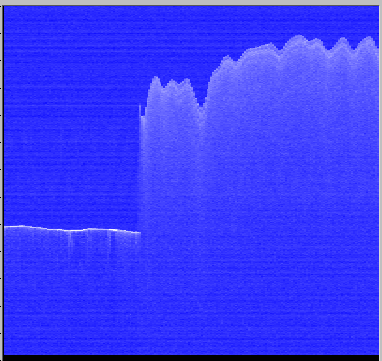
Example quick-look processing (unfocused SAR) MCoRDS data within the downstream region where Blackwall and Recovery Ice Streams merge and go afloat, with basal crevasses visible over the floating ice during a 180º turn
Read more
about Example quick-look processing (unfocused SAR) MCoRDS data within the downstream region where Blackwall and Recovery Ice Streams merge and go afloat, with basal crevasses visible over the floating ice during a 180º turn
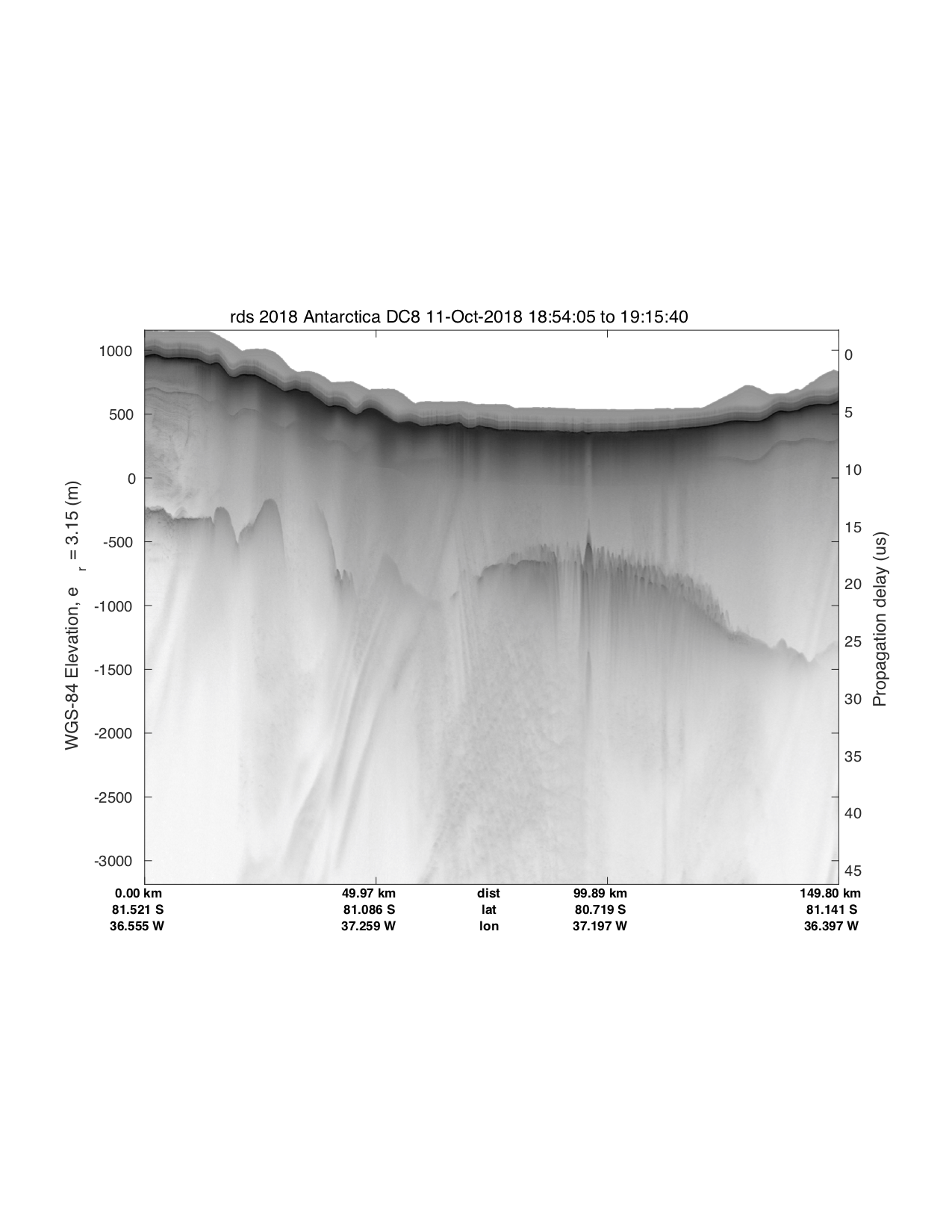
Example ATM T-7 IR narrow-scan (2.5º) elevation quick-look data plot over a crevasse field on Blackwall Ice Stream
Read more
about Example ATM T-7 IR narrow-scan (2.5º) elevation quick-look data plot over a crevasse field on Blackwall Ice Stream
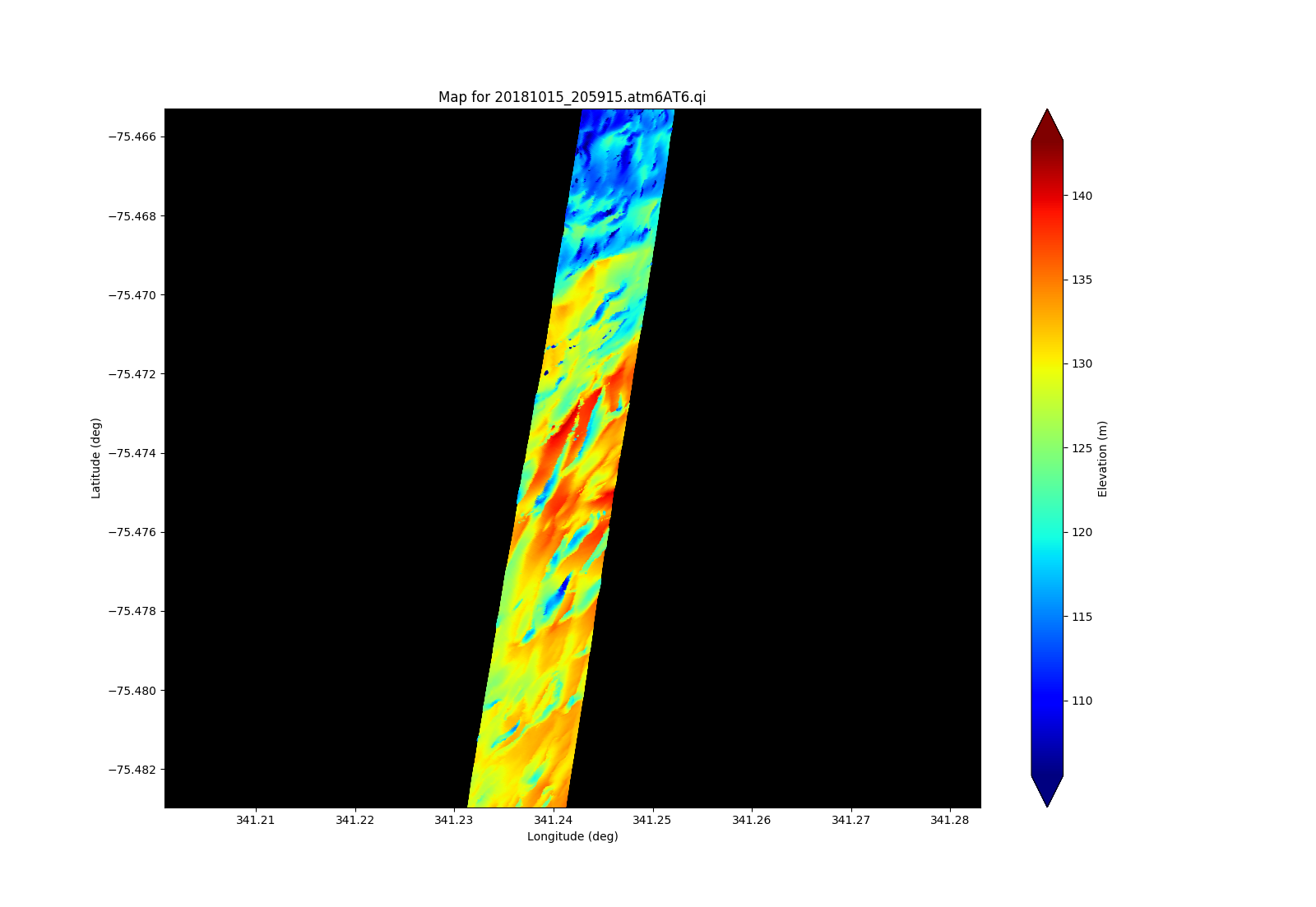
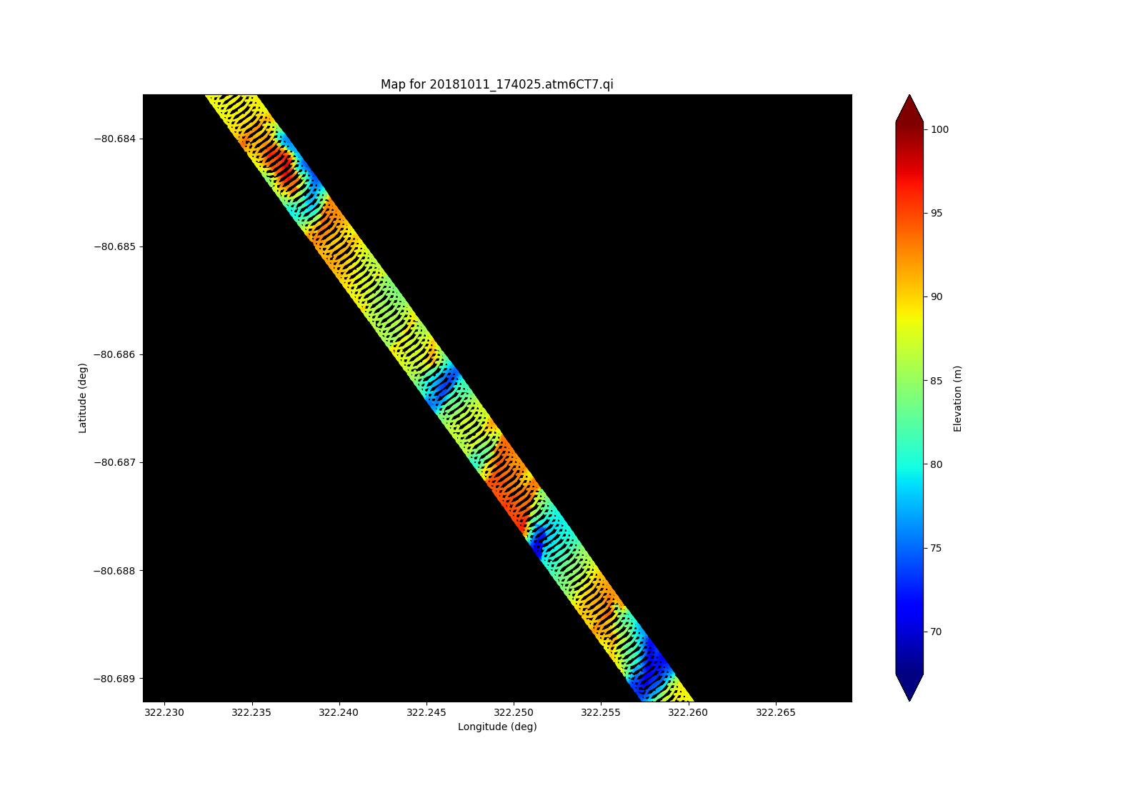
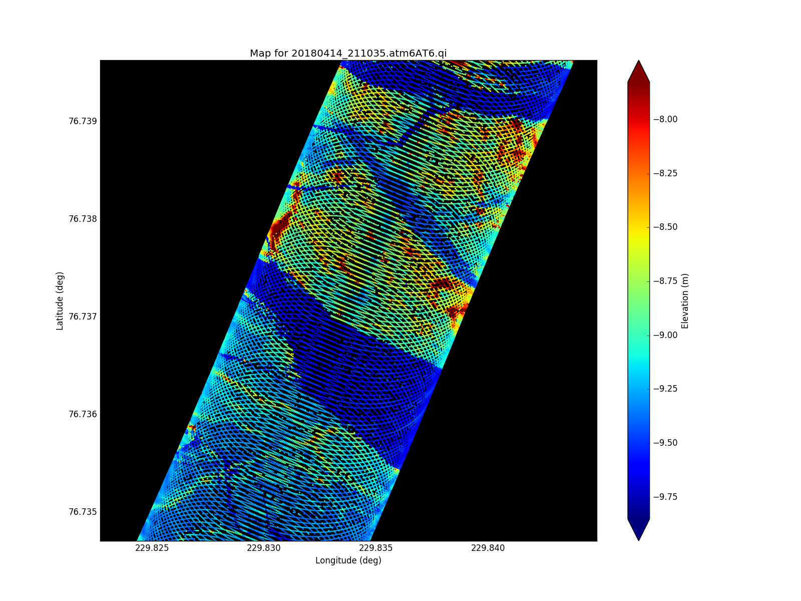
ATM T6 wide-scan swath over a lead
Read more
about ATM T6 wide-scan swath over a lead
960502 ER-2 Flight Track from Nav Recorder
Read more
about 960502 ER-2 Flight Track from Nav Recorder
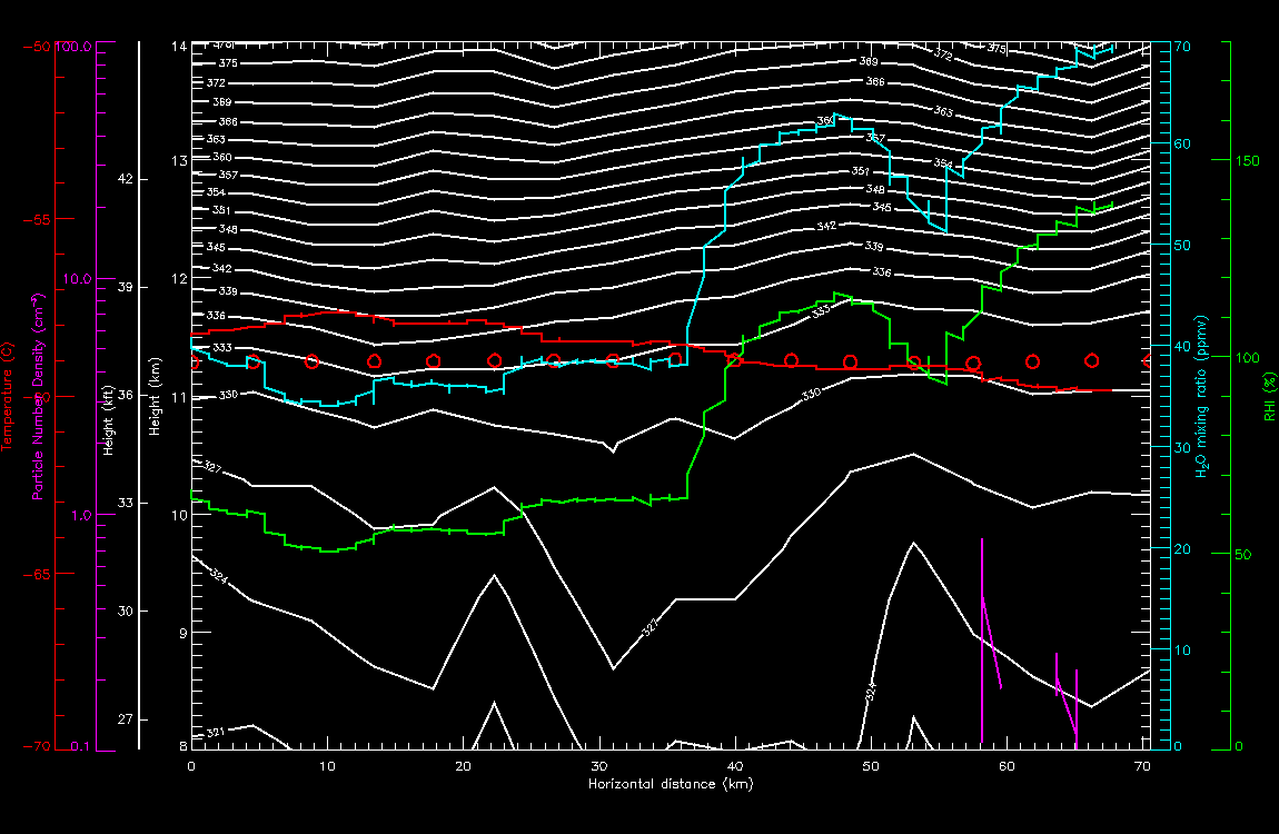
Wave Structure 960502 leg 4
Read more
about Wave Structure 960502 leg 4
Wave Structure 960502 leg 3
Read more
about Wave Structure 960502 leg 3
Pages
« first
‹ previous
…
10
11
12
13
14
15
16
17
18
…
next ›
last »