This site requires that JavaScripts be enabled in your browser. For instructions,
click here
Skip to main content
NASA - National Aeronautics and Space Administration
Browse
ATom
ORACLES
ATTREX
ACCENT
ASHOE/MAESA
AASE II
AASE
AAOE
Other Missions
Upload Files
Help
Archive File Format
Creating Accounts
Archive Configuration
You must have JavaScript enabled to use this form.
›
Log in to Airborne Science
|
›
Create New Account
Log in to Airborne Science
Username
*
Password
*
Create new account
Request new password
Search form
Search
Leave this field blank
Browse
ATom
ORACLES
ATTREX
ACCENT
ASHOE/MAESA
AASE II
AASE
AAOE
Other Missions
POSIDON
MACPEX
GloPac
TC4
Ticosonde06
CR-AVE
AVE (WIIF)
AVE (2005)
PAVE
AVE (2004)
MidCiX
Pre-AVE
BOS
SOLVE II
CRYSTAL-FACE
SOLVE
WAM
SONEX
POLARIS
SUCCESS
TOTE/VOTE
STRAT
SPADE
OMS
STEP
Upload Files
Help
Home
> Data
Image displaying measurement data
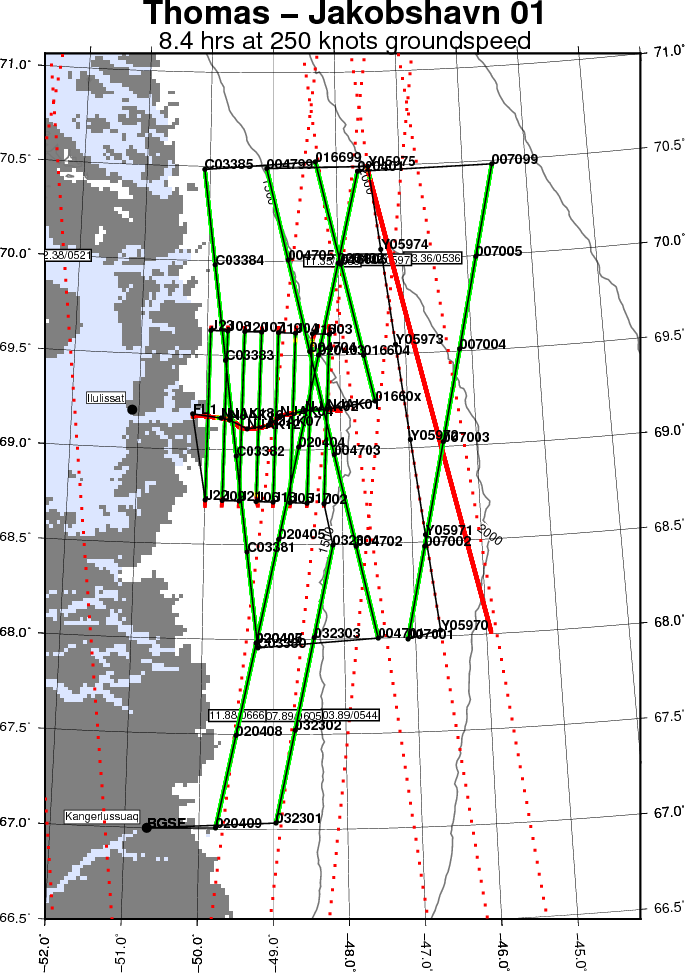
Map of today’s mission
Read more
about Map of today’s mission
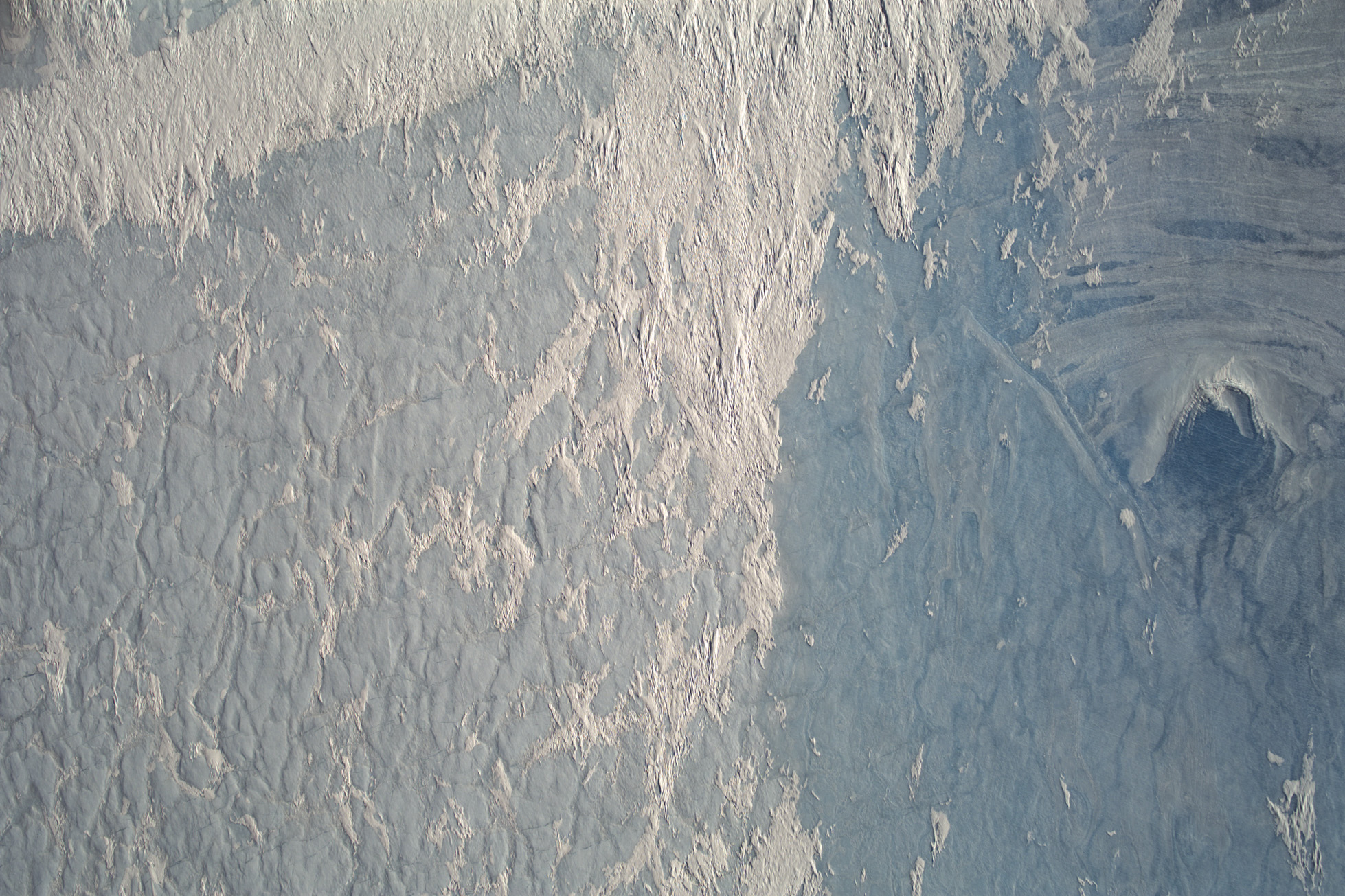
3. CAMBOT image of the Jakobshavn Isbrae calving front (roughly estimated at approximately 100 meters above the water level)
Read more
about 3. CAMBOT image of the Jakobshavn Isbrae calving front (roughly estimated at approximately 100 meters above the water level)
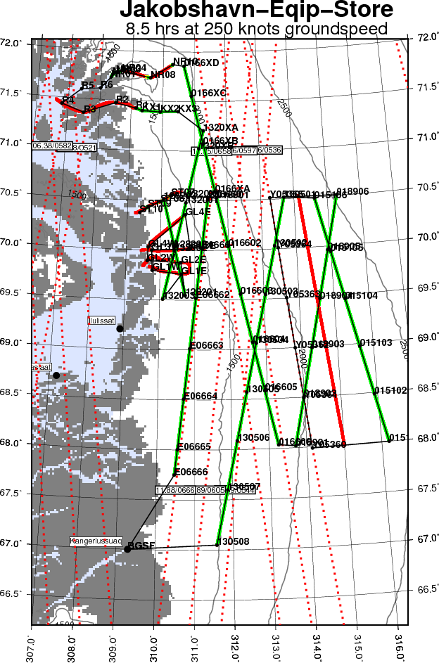
Map of today’s mission
Read more
about Map of today’s mission
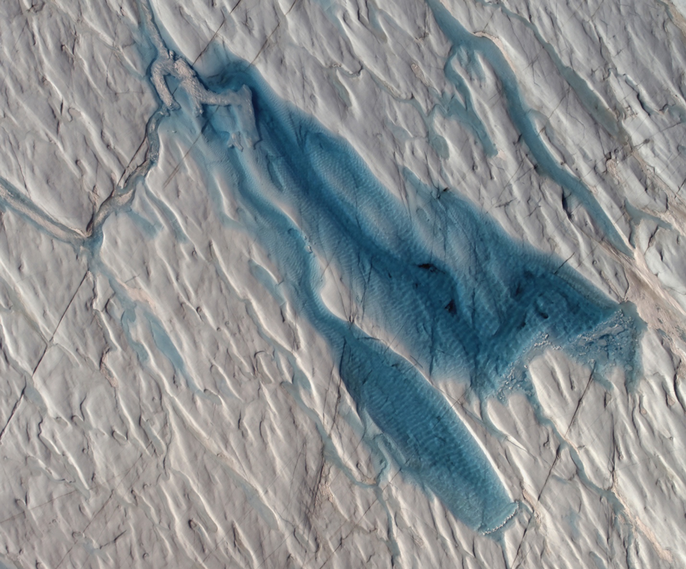
A CAMBOT mosaic of a melt pond with surface rippling
Read more
about A CAMBOT mosaic of a melt pond with surface rippling
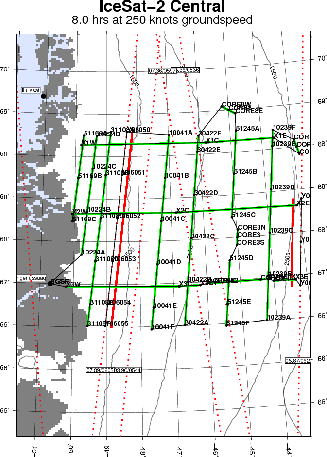
Map of today's mission
Read more
about Map of today's mission
Image 1
Read more
about Image 1
CAMBOT image of leads slicing through pressure ridges
Read more
about CAMBOT image of leads slicing through pressure ridges
CAMBOT image of frozen supraglacial lake on Storstrømmen with a possible moulin on the right side
Read more
about CAMBOT image of frozen supraglacial lake on Storstrømmen with a possible moulin on the right side
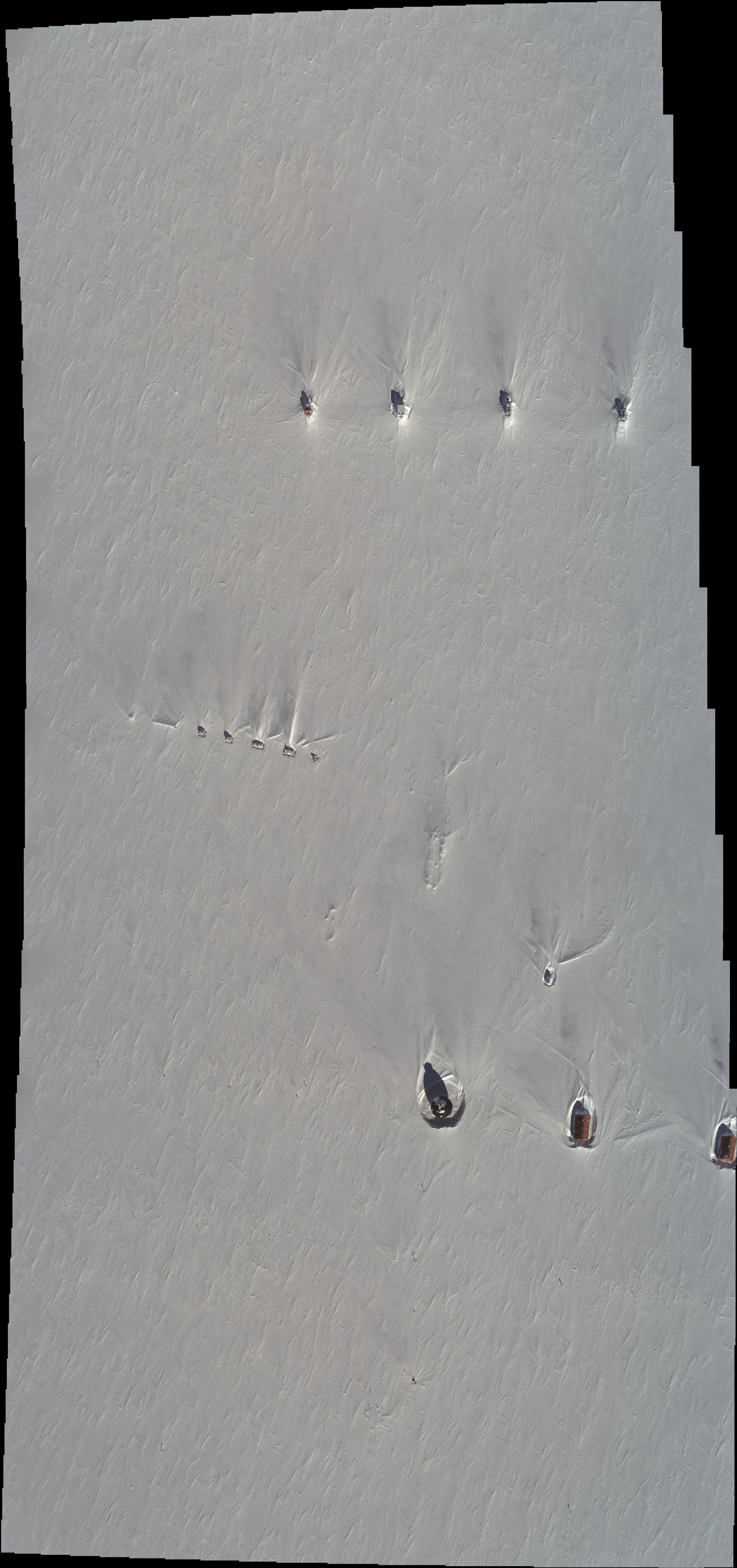
CAMBOT mosaic of EGRIP camp
Read more
about CAMBOT mosaic of EGRIP camp
Stack of 22 CAMBOT images of low clouds in northwestern Greenland, from which green reflections from ATM T-7 are visible
Read more
about Stack of 22 CAMBOT images of low clouds in northwestern Greenland, from which green reflections from ATM T-7 are visible
Pages
« first
‹ previous
…
7
8
9
10
11
12
13
14
15
…
next ›
last »