This site requires that JavaScripts be enabled in your browser. For instructions,
click here
Skip to main content
NASA - National Aeronautics and Space Administration
Browse
ATom
ORACLES
ATTREX
ACCENT
ASHOE/MAESA
AASE II
AASE
AAOE
Other Missions
Upload Files
Help
Archive File Format
Creating Accounts
Archive Configuration
You must have JavaScript enabled to use this form.
›
Log in to Airborne Science
|
›
Create New Account
Log in to Airborne Science
Username
*
Password
*
Create new account
Request new password
Search form
Search
Leave this field blank
Browse
ATom
ORACLES
ATTREX
ACCENT
ASHOE/MAESA
AASE II
AASE
AAOE
Other Missions
POSIDON
MACPEX
GloPac
TC4
Ticosonde06
CR-AVE
AVE (WIIF)
AVE (2005)
PAVE
AVE (2004)
MidCiX
Pre-AVE
BOS
SOLVE II
CRYSTAL-FACE
SOLVE
WAM
SONEX
POLARIS
SUCCESS
TOTE/VOTE
STRAT
SPADE
OMS
STEP
Upload Files
Help
Home
> Data
Image displaying measurement data
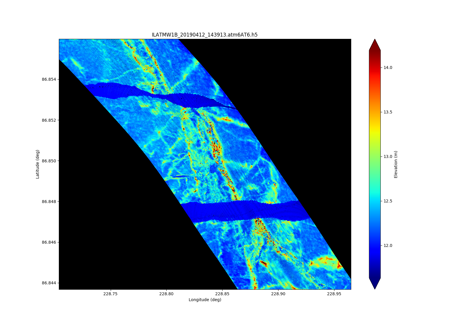
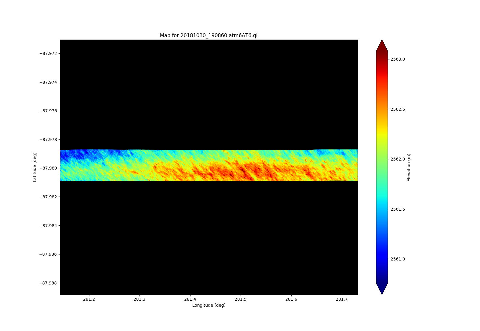
ATM T6 (wide swath) of sea ice leads and pressures ridges not named AL
Read more
about ATM T6 (wide swath) of sea ice leads and pressures ridges not named AL
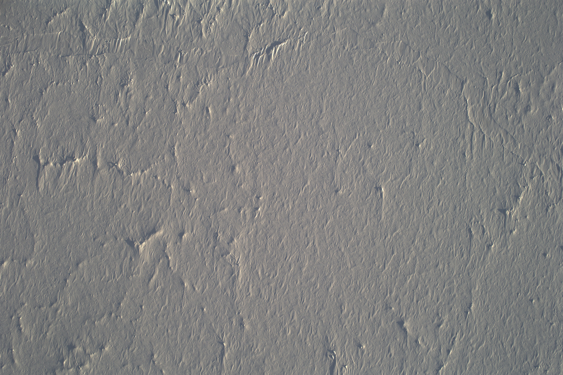
CAMBOT image at time of direct ICESat-2 underflight
Read more
about CAMBOT image at time of direct ICESat-2 underflight
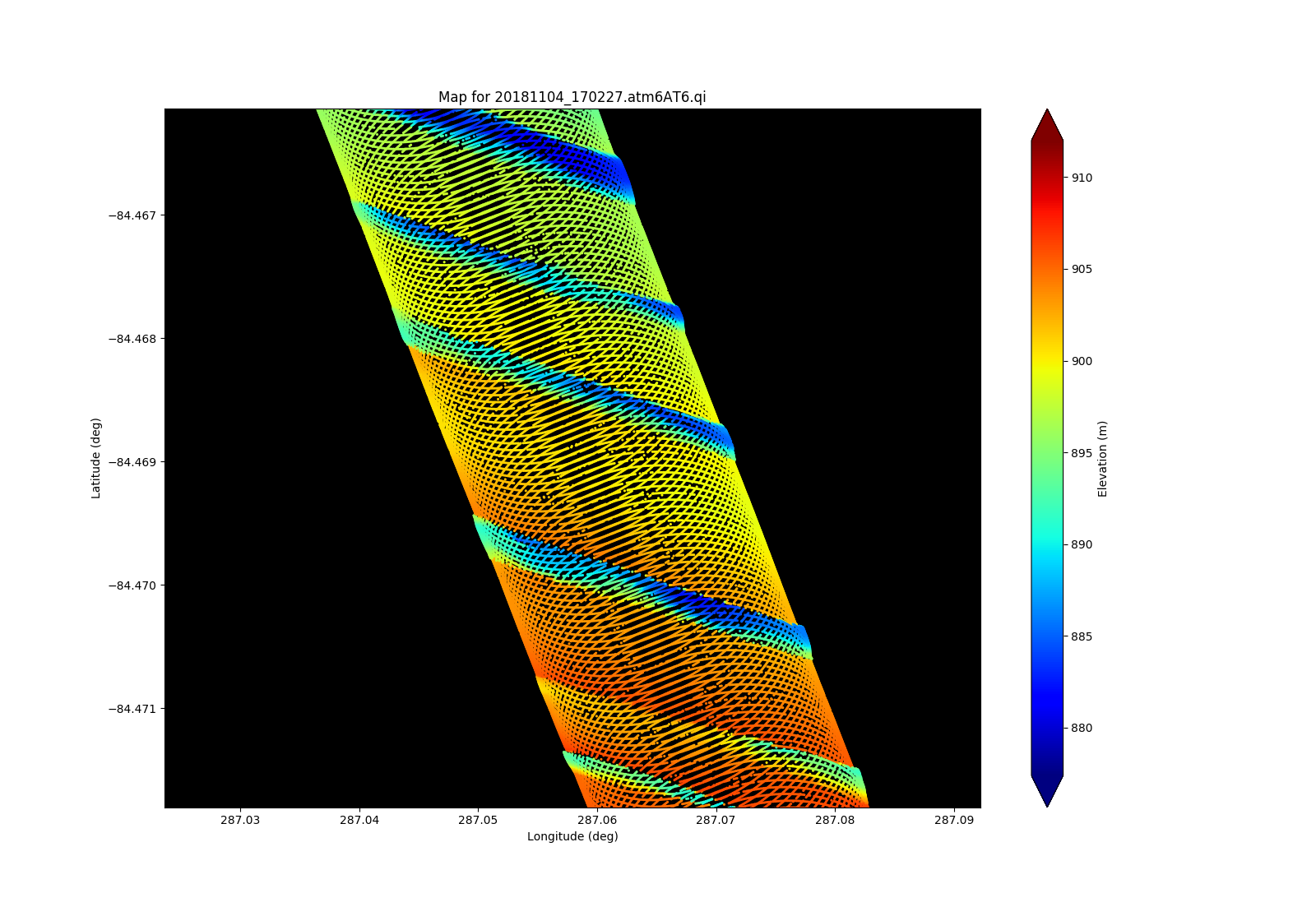
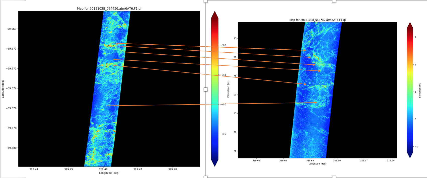
Preliminary ATM T6 elevation swath along all of today’s mission
Read more
about Preliminary ATM T6 elevation swath along all of today’s mission
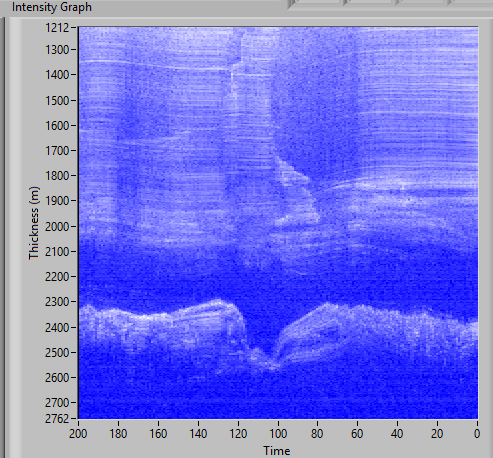
Subglacial trough and layering within Foundation Ice Stream
Read more
about Subglacial trough and layering within Foundation Ice Stream
Subglacial trough and layering within Foundation Ice Stream
Read more
about Subglacial trough and layering within Foundation Ice Stream
Figure 2
Read more
about Figure 2
Figure 2
Read more
about Figure 2
Figure 3
Read more
about Figure 3
Figure 2
Read more
about Figure 2
Figure 2
Read more
about Figure 2
Pages
« first
‹ previous
…
8
9
10
11
12
13
14
15
16
…
next ›
last »