This site requires that JavaScripts be enabled in your browser. For instructions,
click here
Skip to main content
NASA - National Aeronautics and Space Administration
Browse
ATom
ORACLES
ATTREX
ACCENT
ASHOE/MAESA
AASE II
AASE
AAOE
Other Missions
Upload Files
Help
Archive File Format
Creating Accounts
Archive Configuration
You must have JavaScript enabled to use this form.
›
Log in to Airborne Science
|
›
Create New Account
Log in to Airborne Science
Username
*
Password
*
Create new account
Request new password
Search form
Search
Leave this field blank
Browse
ATom
ORACLES
ATTREX
ACCENT
ASHOE/MAESA
AASE II
AASE
AAOE
Other Missions
POSIDON
MACPEX
GloPac
TC4
Ticosonde06
CR-AVE
AVE (WIIF)
AVE (2005)
PAVE
AVE (2004)
MidCiX
Pre-AVE
BOS
SOLVE II
CRYSTAL-FACE
SOLVE
WAM
SONEX
POLARIS
SUCCESS
TOTE/VOTE
STRAT
SPADE
OMS
STEP
Upload Files
Help
Home
> Data
Image displaying measurement data
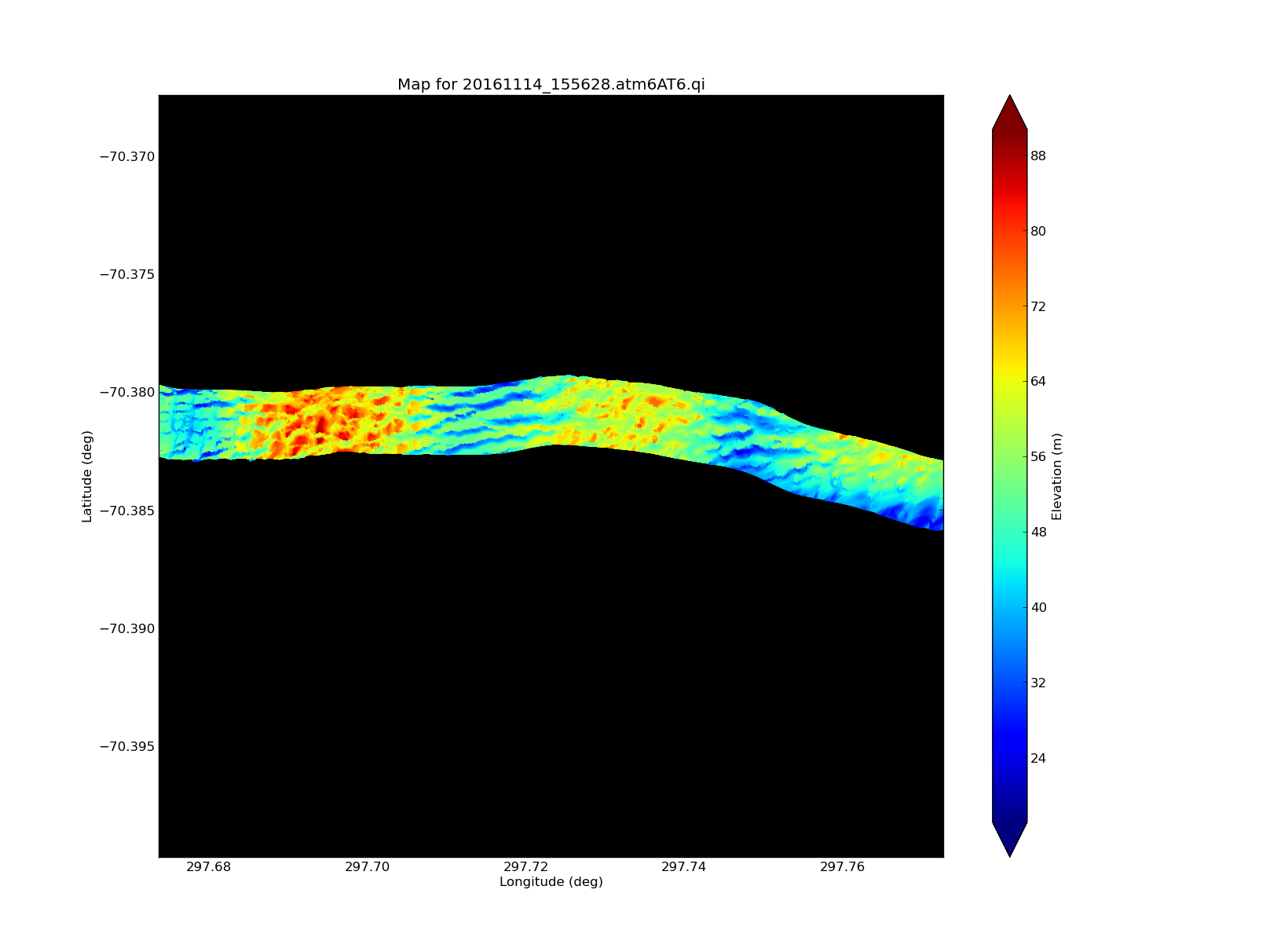
ATM T6 swath map of crevassing
Read more
about ATM T6 swath map of crevassing
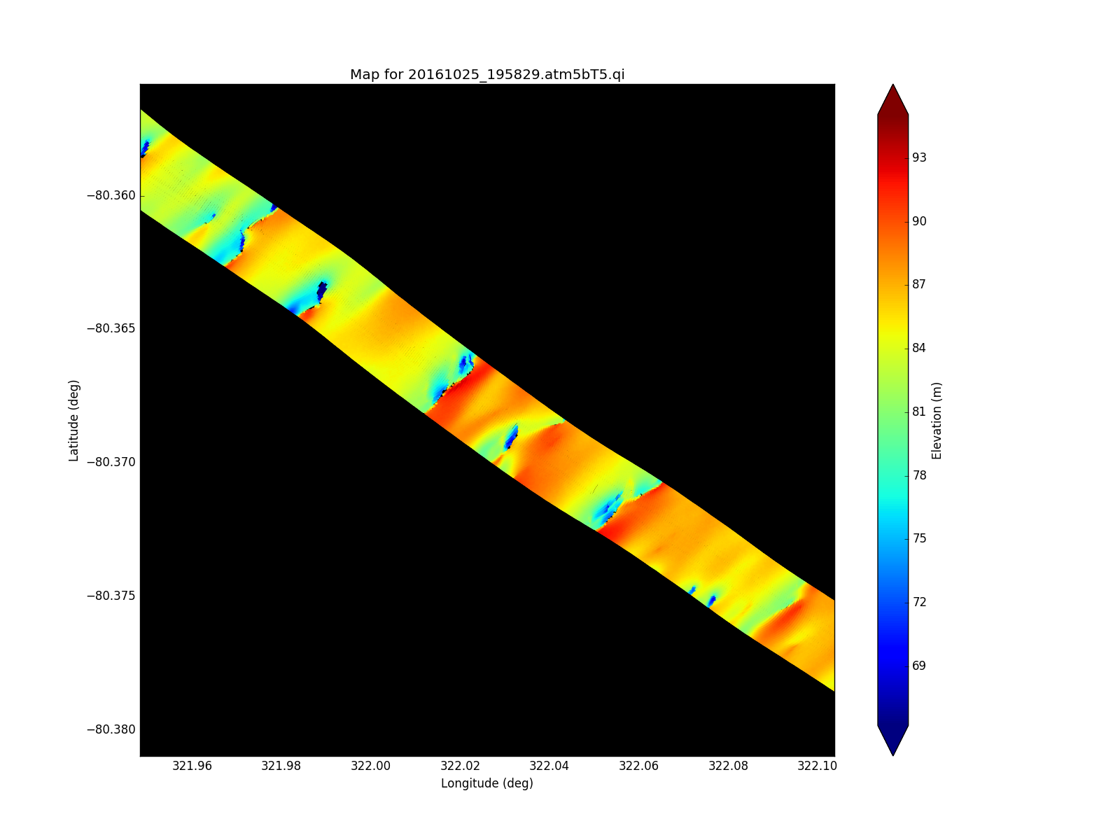
ATM T5 data
Read more
about ATM T5 data
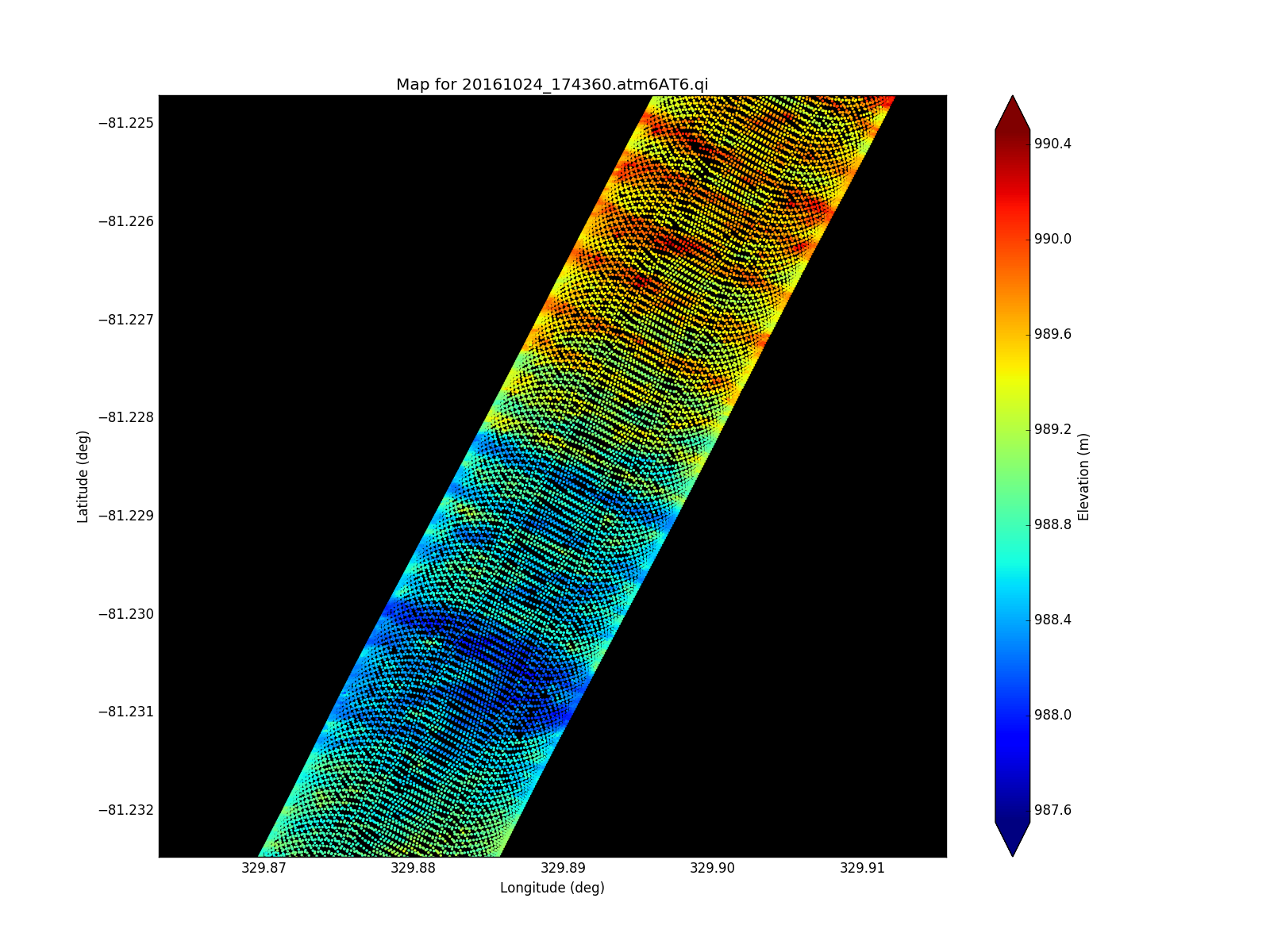
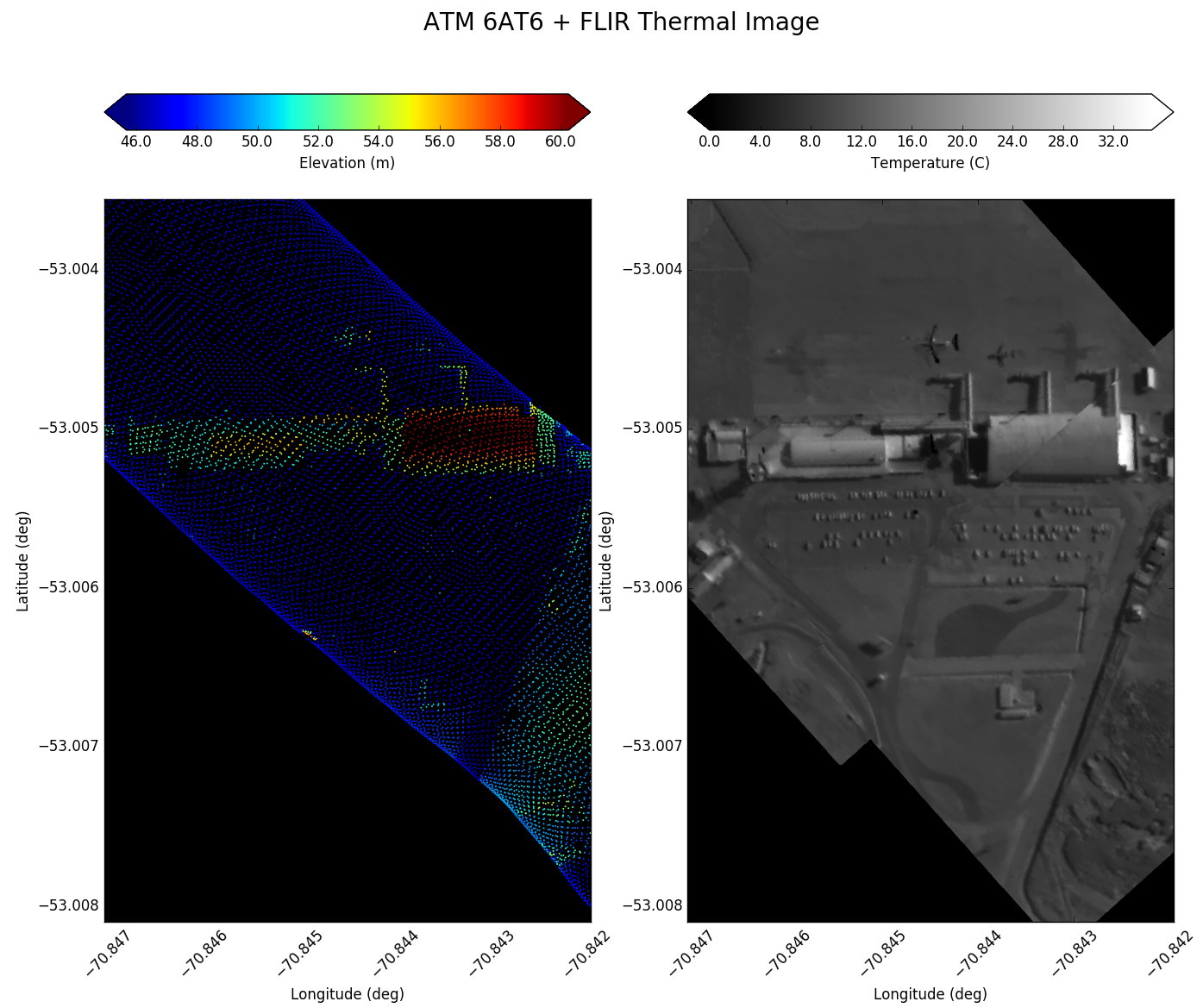
ATM AT6 data sample
Read more
about ATM AT6 data sample
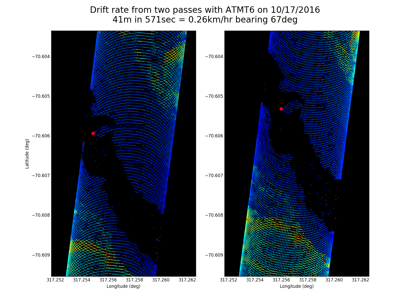
Pack drift from ATM
Read more
about Pack drift from ATM
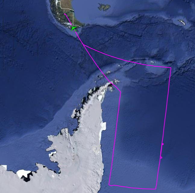
Weddell Sea Ice survey flight track
Read more
about Weddell Sea Ice survey flight track
SCCI Airport images
Read more
about SCCI Airport images
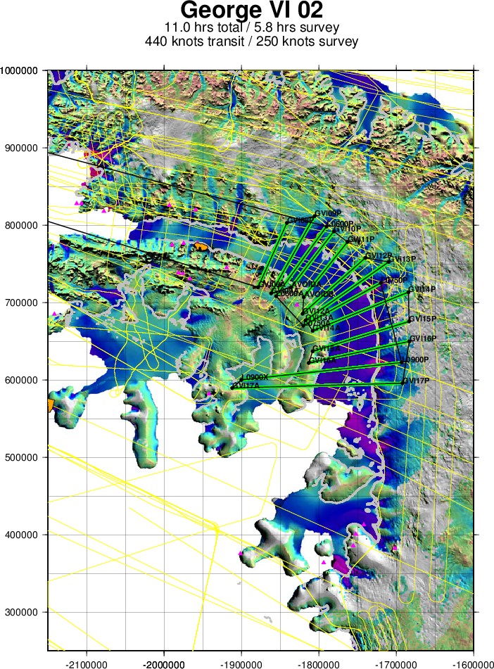
George VI flight track
Read more
about George VI flight track
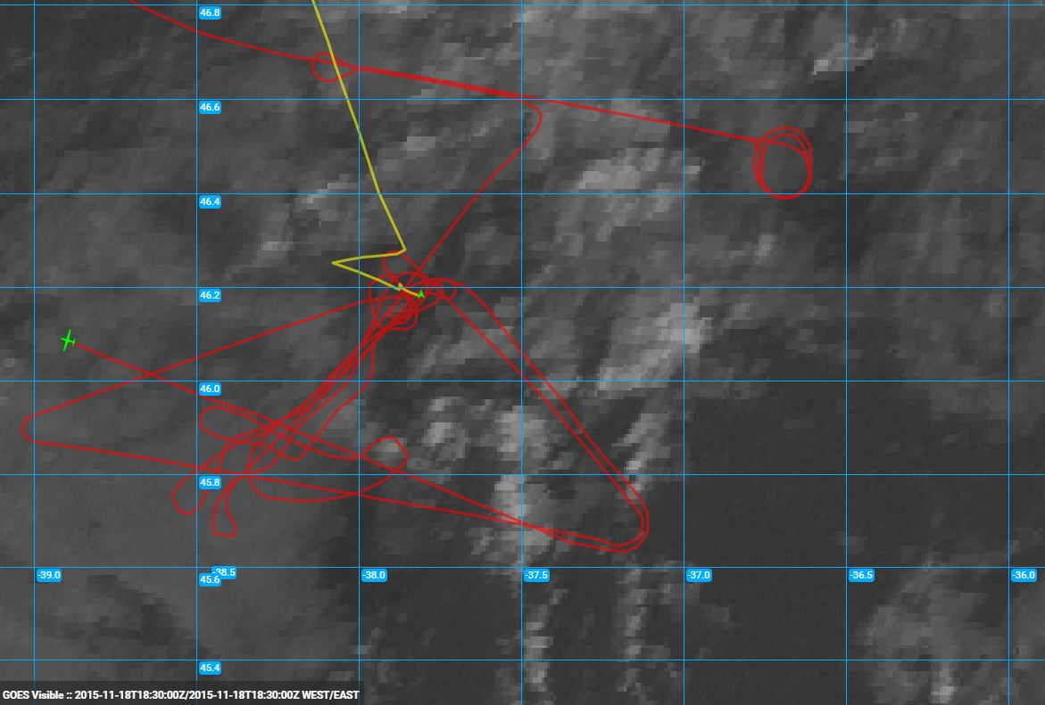
1840Z GOES Visible Imagery and Flight Track
Read more
about 1840Z GOES Visible Imagery and Flight Track
1755Z GOES Visible Imagery and Flight Track
Read more
about 1755Z GOES Visible Imagery and Flight Track
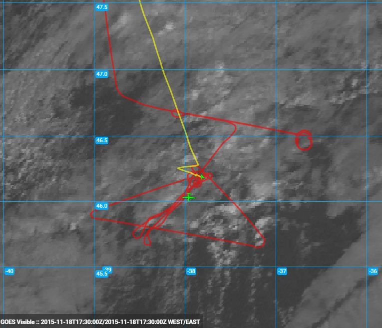
1745Z GOES Visible Imagery and Flight Track
Read more
about 1745Z GOES Visible Imagery and Flight Track
Pages
« first
‹ previous
…
17
18
19
20
21
22
23
24
25
…
next ›
last »