Warning message

Member access has been temporarily disabled. Please try again later.
The website is undergoing a major upgrade that began Friday, October 11th at 5:00 PM PDT. The new upgraded site will be available no later than Monday, October 21st. Until that time, the current site will be visible but logins are disabled.

Flight Track Overlaid on Eddy Map

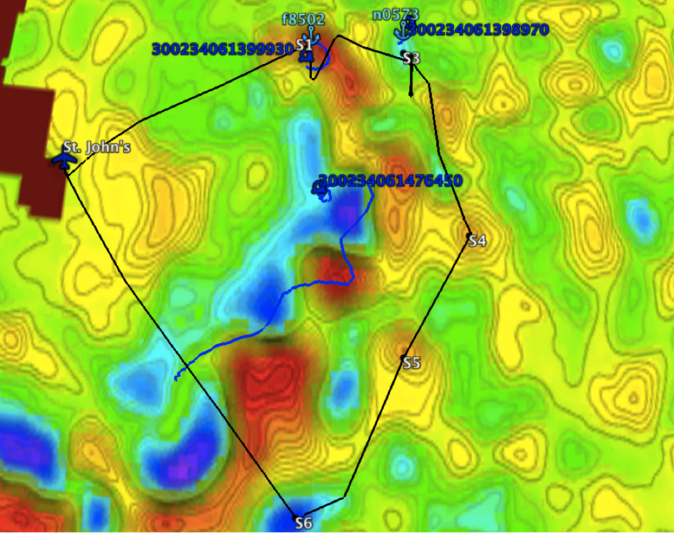
C-130 flight track (black) overlaid on the sea level anomaly (SLA) eddy map. Float (light blue anchors) and drifter (dark blue circles) positions and IDs are also shown. The ship is currently enroute from Point S3 to Point S4. Eddy map courtesy of Peter Gaube.

Subject: